Sunday 18 May 2014

Via Ferrata - Kinlochleven, Scotland

‘Via Ferrata’ means Iron roads. There is a light drizzle of rain and I am sheltered beneath a cluster of trees as I gaze up Grey Mare’s Tail, the fifth highest waterfall in Scotland. Adjacent to the torrent flow of water are rusted iron rungs embedded deep into the rock face.  A steel cable weaves upwards and acts as the agent of safety for our vertical climb. “2 clips on the safety cable and shout ‘below’ if you dislodge any loose rocks!” yells the instructor.

Grey Mare’s Tail
My hands shake with anticipation as I cross a wire bridge towards the vertical climb. Fear mingled with thrill, I steadily begin the climb upwards, clipping in the karabiner alongside me whilst ascending up a steel ladder to access the rock-face. There are a few people climbing in front of me, as I opted to start behind the group. I am here alone and the other climbers consists of a young UK Army group on adventure training, myself, and 2 male walkers.


I worry about my beaten legs as I get higher. Having trekked to the summit of Ben Nevis the day before, my legs emit a tight and dull pain whilst I climb. “Wow” I whisper quietly. I soak in the views as I clamber upwards. The sky is a dark, ominous slate of grey. I am towering above the trees, overlooking the heavy flow of water from Grey Mare’s Tail to my right and the rocky outcrops to my left. The climb isn’t physically strenuous, and I feel a spike of vitality and exuberance. It’s a mixture of the adrenaline and the sheer appreciation for the natural beauty around me. I never envisioned I could do such a unique activity in the UK.


I soon approach a horizontal crossing consisting of a plank of wood held by hanging metal cables. I step straight onto the plank excitedly and my heart jolts in fear as the plank lurches unsteadily. My hands reflectively shoot out to grab the rocky wall in an attempt to steady myself. I remind myself of the instructor’s safety briefing, and how he stated that we would still drop 3 – 4M if we fell whilst harnessed in the safety system.  I brush the thought away but proceed a little more cautiously.

As I edge closer to the waterfall, I feel the spray of water lightly dusted in the air and on my face. I climb higher over the mouth of the waterfall and onto a wooden rope ladder at the end of the Via Ferrata. With a breath of relief, I clamber over the last rung and emerge on a clearing of land next to Grey Mare’s Tail. The instructor gives me a thumbs up and I grin in return with adrenaline and sheer delight coursing through me.


Trip Tips


  • There are only 2 Via Ferrata's in the UK: one in Lake District (Honister Slate Mine) and one in Kinlochleven, Scotland. 
  • I took the 44 bus from Fort William to Kinlochleven. The journey took approximately 1 hour and a single bus ticket was £4.70.
  • The activity takes 3 hours to complete including the safety briefing. The activity cost £39.00 with Vertical Descents. (http://www.verticaldescents.com/via-ferrata/via-ferrata.html)
  • The activity itself isn't very physically strenuous or technical.There is a 'rest clip' on the harness system if you get tired climbing up. I think the main issue for people completing the Via Ferrata is the fear of heights/exposure. 
  • The climb is next to a 90m waterfall, the iron rungs aren't slippery at all. Wear clothes you don't mind getting dirty. 
  • If you have any other questions/queries, feel free to comment here or email me. 

Thursday 8 May 2014

Ben Nevis Hike

"Thank you so much!" I utter gratefully. 3 French walkers from Fort William Backpackers offered me a lift from the hostel 2 miles down the road to the start of the mountain track. The kind gesture saved me 30 - 40 minutes of road-side walking and I was able to begin the trek renewed and ready after breakfast.


The sun is beating down as I cross the suspension bridge to the start of the mountain track. It's a deceptively gentle slope at the beginning. I begin my ascent away from the river and up over a stile. Within an hour, the path became increasingly rocky and steep. I soon find a comfortable and steady pace at the start, taking in the incredible views of trickling waterfalls, large rolling mountains and blue pool lochs. 


The conversations strike up naturally, with fellow walkers musing about the lovely weather and whether I was walking alone. I soon reach Loch Meall T-Suide at 570m, where I drop my rucksack and sit on a rock to contemplate which route to follow.
Left fork: the dangerously beautiful way
Right fork: the summit of Ben Nevis 

Loch Meall T-Suide, often dubbed the 'half way point'
approx 40% of way up.
A family stroll pass me and ask if I'm lost. "I really really really want to go Ben Nevis via North Face, but I don't want to go alone." 
They smile at my statement, but the father suggests against it, stating that the conditions along the arete ridge would be very difficult and that it would be better to have winter equipment. 
I stay for a further twenty minutes and watch every single walker turn right towards the mountain track. In the end, my rationality prevailed over my impulsive stir for a challenge. I decided to continue up the mountain track, following the advice of fellow walkers. 


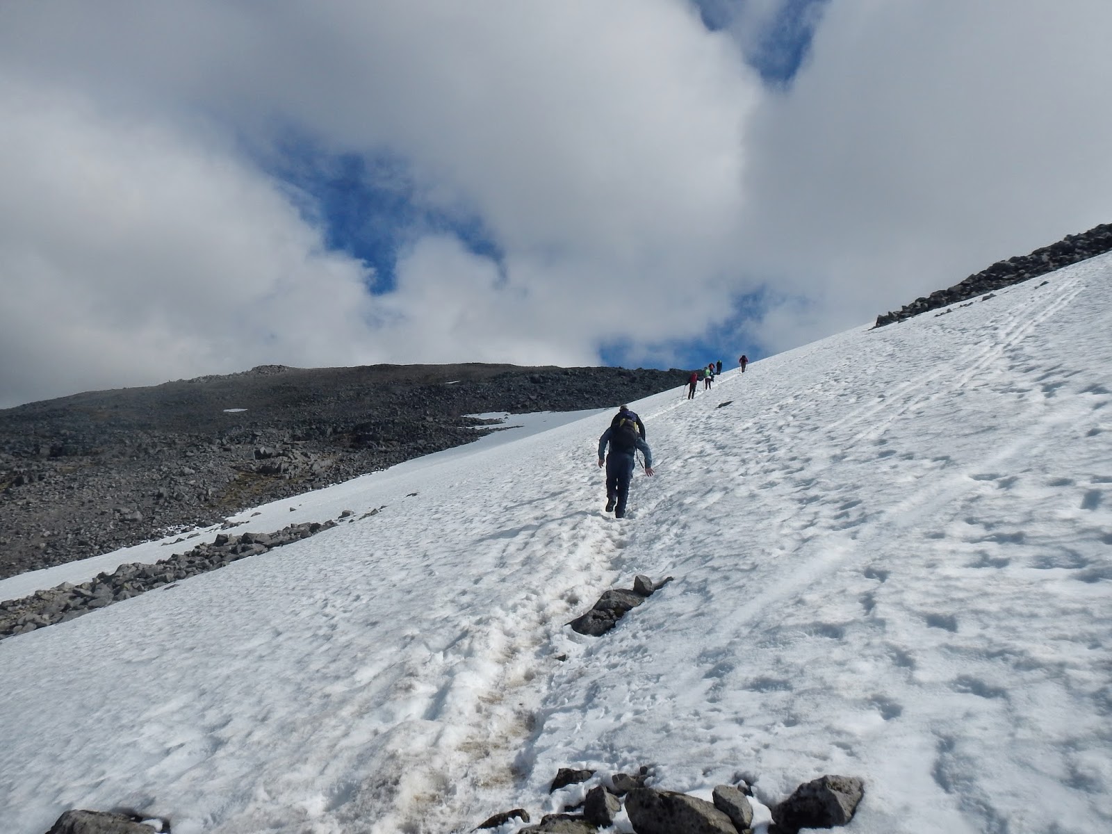
Within an hour of walking, the mountain track suddenly turned into a pathless expanse of white, steep and icy snow.

My eyes widen in surprise. I knew Ben Nevis was snow-capped, but I never envisioned an ascent up an icy slope. I stop and cautiously watch the walkers ahead of me: Stick to the footprints. Take it slowly. Use your walking pole as an anchor for balance.

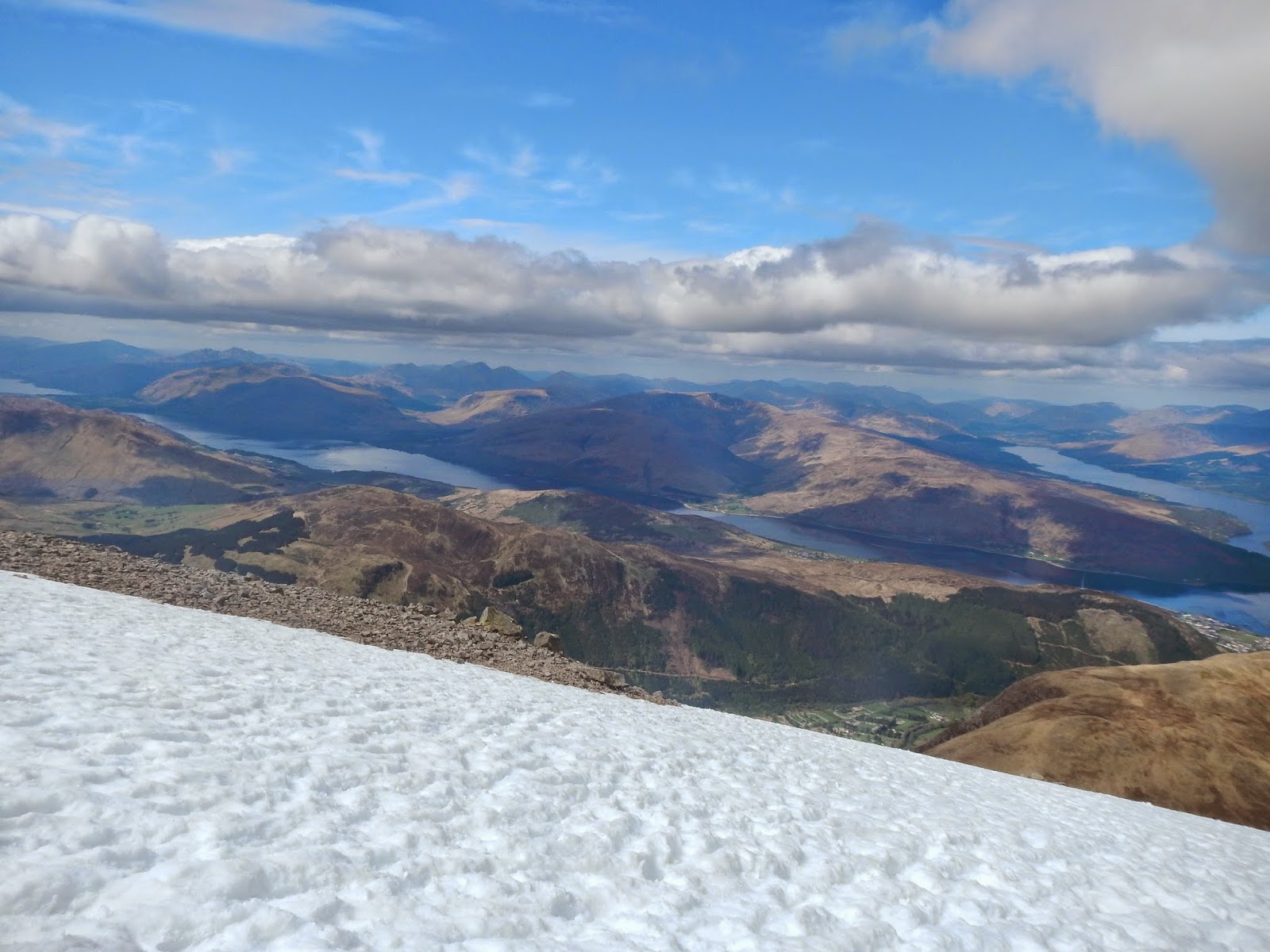
I proceed by taking each step attentively. The snow isn't as bad as it looks, it's a few inches deep, compacted but not too slippery. It's a slow but gradual crawl to the summit. I follow a stream of walkers ahead of me, the visibility is excellent and I soak in the views of white dusted peaks. 


The cairns bob into view, marking the cliff's edge. The slope starts to even out, I glance upwards, see the observatory and the a stone pillar. I'm here! 1344M on top of the UK!

The germans at my hostel were on the summit, whooping and taking pictures. They offer to help me climb the cairn, which is roughly a head shorter then my height.
Me: Don't worry, its ok.
German guy #1: No really, I'm a soldier I can help you!  

I take up the offer and climb up with a helpful boost. We spend 20 minutes on the summit, gradually adding further layers of clothing such as hats, gloves and a snood. 

On the summit! 
We soon begin our descent. The germans speed ahead of me, where as I take measured steps. No way am I going to slide off a cliff today. I bump into the French walkers (the ones who gave me a lift) and greet them cheerfully.
I subsequently bump into the family "Well done!" they shout as we exchange smiles. My heart inflates with joy: the elation of the journey, the summit, and meeting so many caring walkers when I was riddled with doubt about doing it alone. Emotionally, it was fear mingled with anxiety, the unknown, the wanderment and the willingness to tackle them head on. I am outside my comfort zone, but it makes me feel so alive. 

It's a slow descent. I felt a wave of relief as the path changes from snow to rock. I quicken my pace, but my legs/knees begin to twinge in pain. 


Overall, it was approximately 7.5 hours up and down. I trudge back to the hostel and microwave a macaroni cheese as a tasty post hike dinner. To my utter delight, Bank Street Lodge assigned me to a dormitory room with just 3 beds. I spend the evening chatting with Elisha, a Irish girl who'd just walked The West Highland Way, and I sleep soundly after a long yet highly rewarding day.


Trip Tips

  • Transport to Fort William from London was £24.70 x 2 with a YP's railcard. Book way, way in advance to get the cheapest price possible. I booked my tickets approximately 2 months before travel.
  • Navigation wise, the mountain track is very straight forward. I only got my map out once. I did it on a clear day but remember that the weather conditions can cause havoc on your sense of direction. 
  • The alternative route I wanted to do was Ben Nevis via Carn Mor Dearg. This route takes in the view of the North Face, which is missed if you opt for the mountain track. There is a thin, arete ridge to hike across. I hope to return to Ben Nevis and attempt this route in summer conditions. 
  • Accommodation wise, I stayed at both Bank Street Lodge and Fort William backpackers. Both were £17.00 per night with free tea/coffee/wi-fi. I enjoyed my stay at both. Fort William Backpackers had more vibe whilst Bank Street was more comfortable due to a small dormitory.
  • The mountain track is approximately 2 miles from the town centre. Don't forget to make time for this if you do not have a car.
  • My legs really hurt the next morning - be prepared for this! :)
  •  Any further questions or comments about attempting Ben Nevis, please feel free to comment here or email me.